Ground Surveys
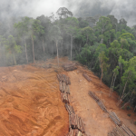
The division conducts land degradation assessment and mapping, biodiversity surveys, habitat mapping for livestock and wildlife, development of herbarium, plant-use documentation, landslide risk mapping and related exercises.
The information and data produced inform disaster risk reduction, land degradation mitigation, and environmental conservation and management.